
Easily Plug Your Data
Generate immediate and actionable results with the step-by-step Project Setup. Quickly load your customer product data and customer data and get started through a few steps.
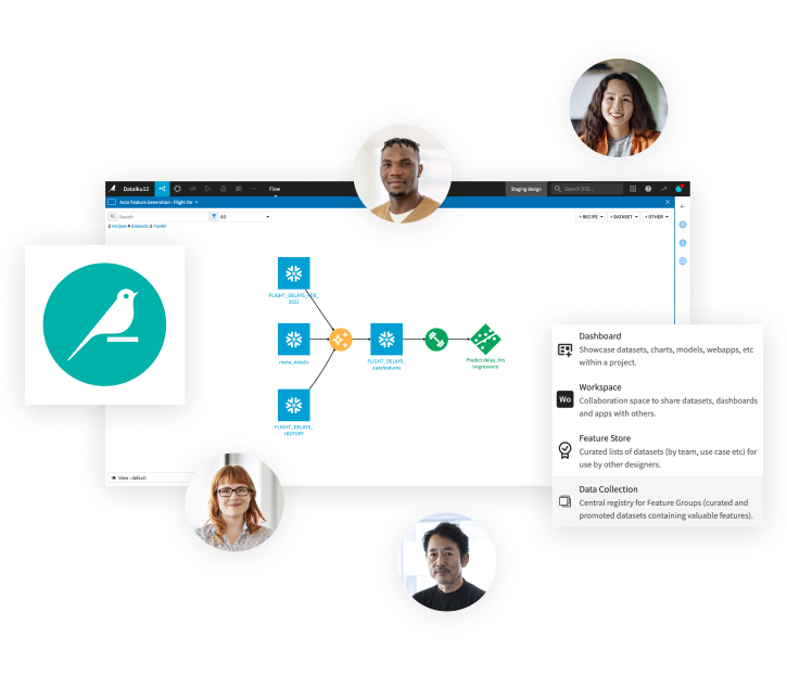
Understand Project Structure
Quickly navigate a visual data pipeline to adjust and extend the flow as needed. Build custom insights on distribution points locations, embed specific metrics such as revenue efficiency, and engage in decision making.
Check Distribution Network Reach
Use open source APIs combined with your data to compute isochrones for each of the point of sales (POS) or distribution spots in your network. Compute a full range of isochrones based on different transportation means to adjust to new trends and perform detailed reviews.
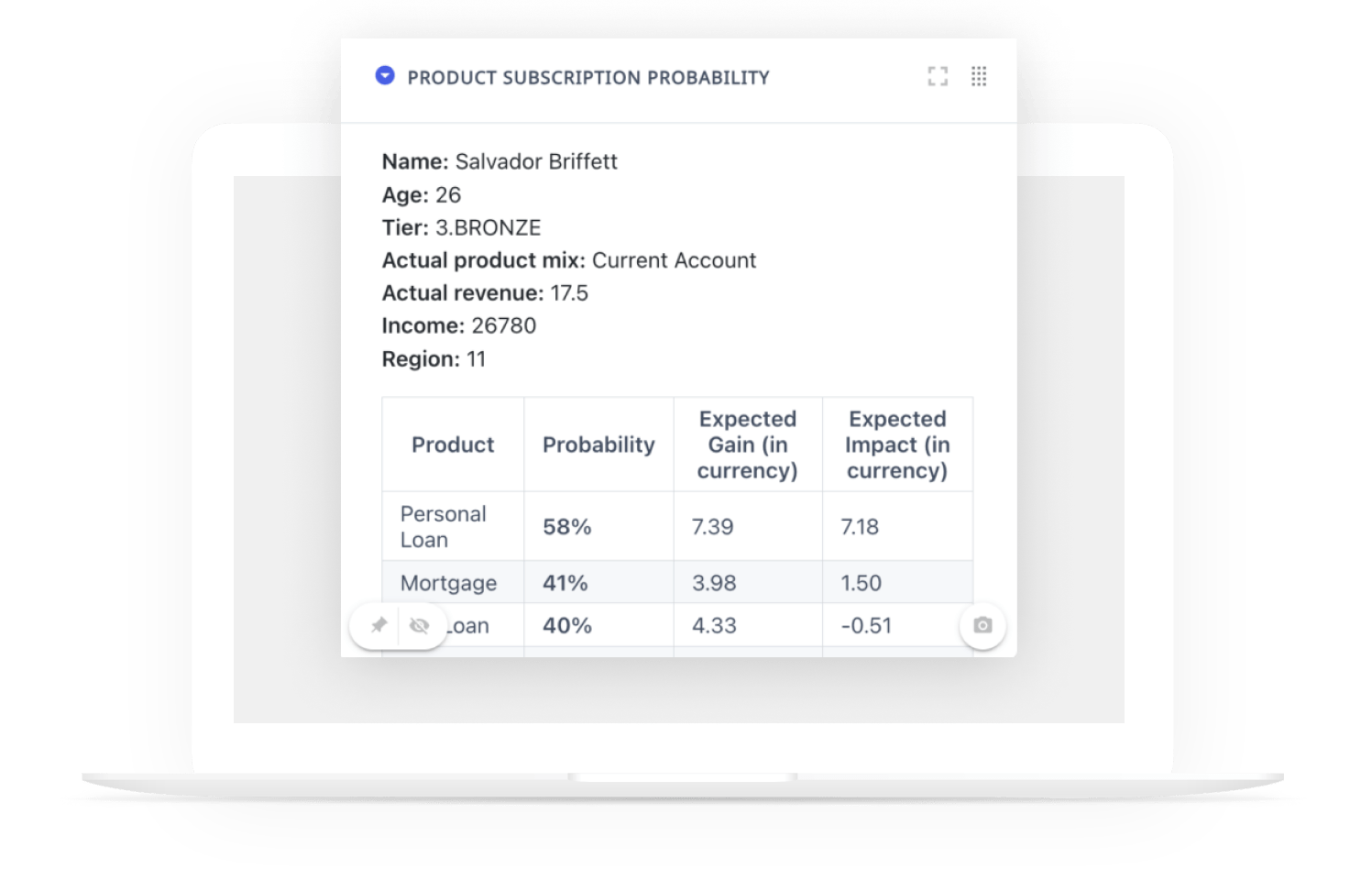
Enhance Geospatial Analysis
Pull in customer data to identify customers located within and outside of your distribution network, then run similar analyses on partners and competitors. With comprehensive visualizations, turn complex data into decision making on points of distribution to keep, gaps in coverage, optimization options, and more.
Understand and
Take Action
Explore insights interactively through a fully fledged Web Application and comprehensive dashboards. Perform multiple analyses, explore impacts of possible decisions in a collaborative manner with marketing, sales, and supply specialists, and accelerate decision making.
Answer Key Questions on Your Distribution and Supply Strategies
The Dataiku Solution for Distribution Spatial Footprint helps answer a broad range of questions like:
- Which stores should I close, open, or relocate?
- Where should I locate my distribution centers?
- How should I deal with cannibalization or competition?
- Which socio-demographic characteristics are in specific catchment areas?
- How should I adapt my POS strategy?
- How can I optimize my marketing campaigns?
Optimize Distribution Strategies With AI
Analyze and optimize your distribution network to find new opportunities and each POS catchment area to better adapt to changing customer expectations.
Adjust your partnership and localization strategies to optimize your networks of suppliers based on coverage needs with a data-driven approach. With the Dataiku Solution for Distribution Spatial Footprint, unlock the potential of geospatial analysis for your organization!

The Total Economic Impact™️
Of Dataiku
A composite organization in the commissioned study conducted by Forrester Consulting on behalf of Dataiku saw the following benefits:
reduction in time spent on data analysis, extraction, and preparation.
reduction in time spent on model lifecycle activities (training, deployment, and monitoring).
return on investment
net present value over three years.